

The Role of Geolocation Data in Modern Accident Investigations
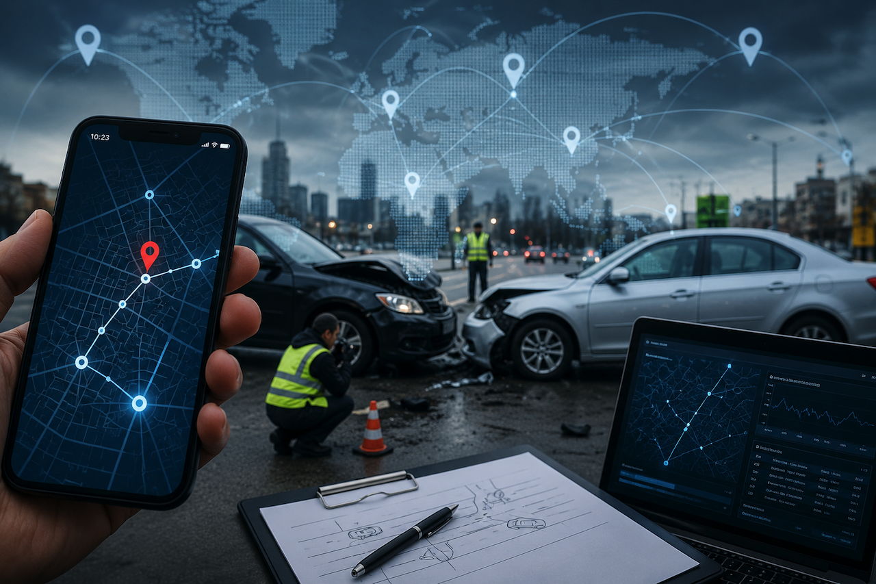
Over the past decade, the quiet expansion of location-aware technology has reshaped how organizations understand movement, behavior, and accountability. What began as a convenience layer for navigation apps and weather services has become a foundational data stream running through logistics, insurance, public safety, and increasingly, the legal system. Geolocation data now sits alongside financial records and communications metadata as one of the most consequential categories of digital information a person generates in a day, and its role in reconstructing what happened during an accident has grown in tandem.
This shift matters because accidents, whether on highways, construction sites, or city sidewalks, have historically been investigated through a combination of physical evidence, eyewitness testimony, and post-event reporting. Each of those sources carries known limitations. Memory fades, debris gets cleared, and witnesses see only fragments of an event. Geolocation data, by contrast, offers a continuous, timestamped record of where devices and the people carrying them were before, during, and after an incident. That continuity is changing the standard of proof that investigators, insurers, and courts now expect.
From GPS Coordinates to a Layered Evidence Stack
Geolocation is often discussed as if it were a single technology, but in practice, it is a layered system that draws on multiple signals. Modern devices triangulate position using a combination of satellite positioning, cellular network data, Wi-Fi access point mapping, Bluetooth beacons, and IP-based inference. Each layer has different accuracy characteristics and different evidentiary value.
Satellite-based GPS and its global counterparts, GLONASS, Galileo, and BeiDou, provide outdoor accuracy generally within a few meters. Cellular triangulation, which estimates location based on signal strength to nearby towers, is less precise but works indoors and in dense urban environments where satellite signals weaken. Wi-Fi positioning relies on databases of known access points and can pinpoint a device inside a specific building. IP-based geolocation, while the coarsest of the methods, remains valuable for establishing the general region from which a device was operating, particularly when other signals are absent or have been disabled.
In an investigation, the strength of a geolocation record usually comes from how these layers corroborate one another. A single GPS ping can be questioned; a coherent trail across satellite, cellular, and Wi-Fi data is far harder to dispute.
How Investigators Use Location Data in Practice
The practical applications of this data have expanded well beyond simple route reconstruction. In vehicle collisions, investigators now routinely pull telematics records from connected cars, which log speed, braking events, steering inputs, and precise position at fractions-of-a-second intervals. Combined with smartphone location histories from drivers and passengers, these records can establish the sequence of events with a clarity that physical evidence alone rarely provides.
Workplace accidents have seen similar changes. Construction sites and warehouses increasingly use Bluetooth or ultra-wideband badges that track worker movement in real time. When an injury occurs, those logs can show whether safety protocols were followed, whether a worker entered a restricted zone, and how long it took for help to arrive. Pedestrian accidents involve a similar mix of sources: traffic camera metadata, the pedestrian's own phone location history, rideshare driver logs, and sometimes data from nearby smart infrastructure.
A few categories of geolocation evidence have become particularly central:
- Device-level location history, including the timeline features now built into most smartphone operating systems
- Vehicle telematics, drawn from the event data recorders and connected services in newer cars
- Third-party app data, where ridesharing, fitness, and delivery apps retain detailed location logs
- Network-side records, including cell tower connection logs and IP session data held by carriers and service providers
Each of these sources has its own retention period, access requirements, and legal threshold for disclosure, at which point the investigation phase begins to intersect heavily with the legal one.
The Operational Impact on Claims and Litigation
For insurers and legal practitioners, the availability of granular location data has shifted both strategy and timing. Claims that once took months to investigate can now be assessed in days when telematics and device data are accessible, and disputes that previously relied on competing accounts can be resolved by reference to a shared digital record. The flip side is that the volume and complexity of this evidence have raised the bar for what constitutes competent representation, particularly for injured parties who may not realize how quickly relevant data can be lost.
Retention windows are a recurring problem. Carriers may retain detailed cell location records only for a limited period before purging or anonymizing them. App developers vary widely in how long they retain precise location histories. Vehicle data, depending on the manufacturer, may be overwritten within days or held only until the next service appointment. In jurisdictions with heavy traffic and complex transit systems, this race against retention can determine whether a case has the evidence it needs. For example, a personal injury attorney investigating a serious traffic collision may move quickly to issue preservation letters to carriers, rideshare companies, and vehicle manufacturers, since waiting until the formal discovery phase can increase the risk of incomplete or unavailable records.
Beyond preservation, the interpretation of location data has become a discipline in its own right. Raw coordinate logs rarely speak for themselves. They require contextualization, such as the accuracy radius at the time of the ping, whether the device was stationary or moving, and how the data was synchronized across services. Courts have grown more sophisticated in evaluating these nuances, but the underlying complexity means that both plaintiffs and defendants increasingly rely on expert witnesses to translate logs into narrative.
The Evolving Ecosystem Behind the Data
The infrastructure producing this evidence is itself evolving in ways that will shape investigations in the coming years. Operating system vendors have moved toward giving users more granular control over location sharing, with permission models that distinguish between precise and approximate location, foreground and background access, and one-time versus persistent sharing. These changes improve privacy but also fragment the evidentiary record, since data that was once collected by default may now exist only if a user opted in.
At the same time, the broader ecosystem has grown denser. Connected vehicles, smart traffic signals, municipal sensor networks, and the slow rollout of vehicle-to-everything communication standards mean that an accident in an urban environment may be captured by half a dozen independent systems. Cloud platforms that aggregate and time-synchronize these feeds are emerging, and the legal frameworks around access to them are still being written.
IP-based geolocation occupies a particular niche in this ecosystem. While less precise than satellite or cellular methods, it is often the only signal available for actions taken on a laptop or other stationary device, and it helps establish the location of communications, online transactions, and account access in the period surrounding an incident. For investigators trying to corroborate a timeline across both physical and digital activity, IP records frequently serve as a connective layer.
Risks, Limitations, and the Privacy Question
For all its evidentiary power, geolocation data carries real limitations and real risks. Accuracy varies considerably across environments, devices, and methods, and treating any single data point as definitive can lead to flawed conclusions. Urban canyon effects, indoor signal reflection, and the inherent imprecision of IP-based inference all introduce uncertainty that must be acknowledged.
The privacy dimension is even more difficult. The same data streams that help reconstruct an accident also document the everyday movements of millions of people who will never be involved in one. Regulatory frameworks in Europe under the GDPR and a patchwork of state laws in the United States have begun to constrain how this data can be collected, retained, and disclosed, but enforcement remains uneven. There is also a growing concern about the asymmetry of access; large insurers and corporate defendants often have far easier paths to comprehensive data than individual claimants, which can affect outcomes in ways the legal system is still working to address.
Misinterpretation is another risk. A location log showing a device near the scene of an accident is not proof that the person carrying it was involved. Courts have seen cases in which overreliance on geolocation data has led to wrongful accusations, and the discipline of presenting such evidence responsibly is still maturing.
What Comes Next
The trajectory is clear even if the specifics remain unsettled. Accident investigations will continue to draw on richer, more interconnected location data, and the questions of accuracy, retention, access, and interpretation will move from technical concerns to central legal and policy debates. Standards bodies are beginning to address how telematics data should be formatted and preserved, and courts are gradually developing more consistent approaches to admissibility.
For ordinary readers, the practical takeaway is that the digital trail surrounding any significant incident is now both denser and more fragile than most people assume. Understanding that landscape, what is being collected, how long it persists, and who can access it, is becoming part of basic digital literacy, not just a specialist concern. The technology that quietly maps our daily movements has become, almost without announcement, one of the most consequential witnesses in the modern accident investigation.
Conclusion
Geolocation data has become an increasingly important part of modern accident investigations. From GPS histories and vehicle telematics to Wi-Fi positioning and IP-based records, digital location evidence now helps investigators reconstruct timelines, verify claims, and interpret events with a level of detail that was rarely possible in the past.
At the same time, these technologies introduce new challenges involving privacy, data retention, interpretation, and evidentiary reliability. As connected devices and digital infrastructure continue to expand, understanding how geolocation evidence is collected and used will become increasingly important for investigators, legal professionals, insurers, and everyday users alike.
Featured Image generated by ChatGPT.
Related Articles
May 5, 2026
How Location Data Is Becoming Critical Evidence in Modern Disputes
Location data has become one of the most decisive forms of evidence in modern disputes, often answering questions that witnesses, documents, or CCTV leave unresolved. Across cr...
Read More
June 18, 2025
How Geolocation Data is Transforming Field Service Management
The integration of geolocation data into Field Service Management (FSM) is revolutionizing how companies manage their on-site operations. As industries increasingly embrace digital...
Read More
January 12, 2025
The Role of Accurate Geolocation in Modern Urban Planning for Smarter, Sustainable Cities
Urban planning has come a long way, and accurate geolocation is now at the heart of its evolution. As cities grow smarter and more connected, understanding the precise location of...
Read More
Comments
Comments are moderated to keep the discussion useful and respectful. Spam, automated submissions, and low-value promotional comments are removed. Comments with outbound links may be approved when the link is relevant to the article and genuinely helpful to readers.
No comments have been published yet.